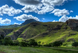
Lesotho’s land cover information on the status of national natural resources is critical for evidence-based decision making in the protection of the natural resource base and safeguarding of rural livelihoods
The Food and Agriculture Organization of the United Nations (FAO) delivered training aimed at building capacity of relevant national institution for the use of Earth Observations data and machine learning to produce annual national land cover maps and to extract land cover statistics.
The training was conducted under the FAO project “Land Cover Data for Integrated Catchment Management (ICM) in Lesotho” financially supported by the European Union through GIZ. The project is Coordinated by the Ministry of Water, ICM Unit, on behalf of the Government of Lesotho.
“Landcover data is crucial in all planning. It is really important in monitoring how our cropland is doing and those involved in animal production can check the status of grassland. We were concerned about the grassland, the shrubland and the cropland; knowing the shrinkage or increasing of the Landcover classes will be crucial for that,” said Selebalo Ramakhanna, soil senior research officer, Ministry of Agriculture and Food Security, who attended the training.
The Lesotho land cover data will establish the current status and identify long-term trends of key natural resource in the country. The data will facilitate the measurement of land degradation of different scales ranging from the plot level to the national level.
On the first half day of the workshop, participants were initially exposed to the key component of FAO’s newly developed land cover mapping methodology, and the supporting theoretical framework. Subsequently the rest of the Workshop was dedicated to hands-on exercises during which participants could carry out all the steps along the land cover data production chain. Finally, they could individually create a national land cover map for the reference year 2021.
At grassroots level, the Landcover information will help farmers the end users, through the assistance of extensions, to better plan their grazing systems.